Monday, December 12, 2011

Arch Rock, Bear Valley Trail, Point Reyes

Bear Valley Visitor Center to Arch Rock, Point Reyes, California


Distance: 8.8 miles, out and back.

Parking: Plenty at the Bear Valley Visitor Center, but get there early on weekends.

Address: 1 Bear Valley Road, Point Reyes Station, CA 94956

Hike: This was the second group hike with Achint, Bincy and Sahana, with Vinay sitting this one out. We decided to head back to Point Reyes, and this time visit Arch Rock. This place is an arch formed on a cliff face over years of erosion and is accessible only at low tides. The arch at the base of the cliff provides access to a super secluded beach so close to the bay area, its mildly shocking, albeit pleasantly. A two hour car ride gets you to the trail head at the bear valley visitor center. You just have to head southwards on the trail for about 3.9mi when you will see some signs directing you towards Arch Rock. This trail is quite close to the coast trail which takes you to Wildcat beach(Alamere Falls), and thus is a very pretty walk. There is no elevation change to speak of, and should be a reasonably simple stroll. There is some scrambling at the end of the hike when you have to endure to get down to the arch from the top of the cliff. This isn't as bad as the Alamere fall cliff, but having said that, you would want to watch out for very slippery rocks. If you don't stop too often like I do for pictures, you should be done with this hike in slightly over 4 hours, after budgeting a 30 minute stop to just ogle at the cliffs and the ocean.

Maps: Point Reyes NPS


Images from the hike:


Non HDR and HDR image of Arch Rock.

Other images from the hike.


Tuesday, November 29, 2011

Alamere Falls

Palomarin to Alamere Falls, Point Reyes National Seashore, California.


Distance: About 8miles out and back.

Parking: Plenty at the Palomarin trail head and its free.

Address: North end of Mesa Rd, Bolinas, CA 94924

Hike: This was our first group hike in the bay area. Achint, Bincy, Vinay, Sahana and me got to this wondrous location after a close to 2 hour drive from the south bay. It is totally worth the drive!

Once you are at the Palomarin trail head, you need to hop on to the Ocean trail going north. This has to be the most beautiful trail I have been on in the bay area, with the trail hugging the ocean through most of its 4mi  distance. About a mile from the trail head there is a clearing which will afford some breath taking views of sunsets on the way back, keep this spot in mind with your return plans. After a mile of not so spectacular vistas we will hit two lakes with pristine blue water, which now, I am aware of being open to swimmers. Dang it! Anyway it is too cold at the end of November to attempt swimming,or so I console myself.

A few brief encounters with banana slugs later, we make it to a spur which says we have an arduous 0.4mi hike to the top of Alamere falls in pretty awful conditions. That being no deterrent we waded through thick bush laden with poison oak, so pants and long sleeves are definitely recommended. The pants will also help with the scrambling you will have to endure to get to the beach at the bottom of the falls. The end of this 0.4mi stretch brings you to a opening with a couple of cascades with the final flourish of water at the third cascade emptying into the ocean. There is a steep cliff with rocks at the bottom, so be careful while trying to get some views from the top. You can then proceed to scramble down a deteriorating path of rocks to the beach to get better views.

Maps: Point Reyes NPS

Images from the hike:


Sunday, November 27, 2011

Monterey Bay Aquarium

Monterey Bay Aquarium, Monetrey, CA


Life and light at the fascinating aquarium. This is a collection of images shot during my visit to the aquarium during the Thanksgiving weekend, November 2011.


Monday, November 21, 2011

Walton Lighthouse

Walton Lighthouse, Santa Cruz

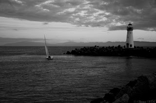
These images were captured a few minutes either side of sunset near Walton Lighthouse in Santa Cruz,CA.

Walton Lighthouse

Sunday, October 16, 2011

Berry Creek Falls

 Big Basin Redwood State Park


The Berry Creek Falls Loop ~12mi round trip


This has to be one of the most challenging and rewarding hikes in the redwoods of the bay area. Having said that you will need the following to make the most of this beautiful piece of redwood paradise.

Park Address: 21600 Big Basin Way, Boulder Creek, CA 95006. $10 day use charge.

Best Time to visit: Beautiful and accessible all through the year. Although, it would be best if you call in advance to check for trail conditions just after a stormy week with heavy rain.

Map: The best map I have found was at this blog.

Hike Description: There are four options to hike upto the Berry Creek Falls and back, all of them starting at the park HQ. You could choose to start by accessing the Sunset trail first, onto the Berry Creek Falls trail and back on to the Skyline to Sea Trail, all of which covers about 11.6mi around the loop. This option takes you along in a counter-clockwise direction to the falls and back from the park HQ. The second option would be to do the previous loop in a clockwise fashion, with a somewhat tougher climb back on the Sunset trail. The last two options would be to take either trail and do an "out and back" on those trails. The mileage would slightly differ in that, the Sunset - Berry Creek trail(counter clockwise) would be a 6.4mi one way hike, while the Skyline to the Sea Trail is a roughly 4mi hike one way. Caveat: Either route is sufficiently strenuous and as such should be attempted with caution.

We took the first trail path going counter clockwise to spread the steep climbing more evenly. To get to the Sunset trail we first went to the "additional parking" area just along the road from the toll booth. As soon as you cross the bridge along the Middle ridge fire road, turn left onto the Creeping forest trail for about 0.1mi, make a right on the Dool trail for another 0.1mi. At this point you will reach a fork which splits into the Dool and Sunset trail, keep left onto the Sunset trail for about 4.9mi. After an initial climb for about 0.5mi, you should find the going relatively easier, although there will be some more climbing to do after a while. At the end of the 5mi you will turn left onto the Berry Creek Falls trail, which has to be one of the most beautiful things you will do in the Bay Area, I am certain. You will be treated to the Golden Cascade and the Silver Falls as soon as you are on the trail. You have to negotiate slippery rocks along the Silver Falls and hike down from its precipice with the helps of wires which the park has installed. Once you get to the bottom of the falls its about a mile to the Berry Creek falls, which is absolutely gorgeous. After spending a few minutes on the viewing platform, which will invariably be crowded, we headed back on the Skyline to Sea trail towards park HQ. Make sure you stop for lunch, hydrate yourself well all along the return path to ensure you don't suffer cramps. Be prepared for some tough climbing back up to the parking lot. You will remember this hike fondly for a long time after.


Images from the hike

Please respect the copyright of the images.
© 2011 Varun Ramaswamy